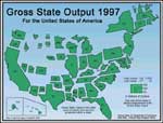
A cartogram is used when a cartographer uses data figures to reflect the size of an area on the map. This is a map that shows each states output of goods, it is reflected in the size of the state. Notice how states in the mid-west are very small in comparison to their actual area.
No comments:
Post a Comment